Southern Norway, the area I call my neck of the woods, boasts some really breathtaking coastal landscapes. The deep fjords, the majestic mountains, and the picturesque islands. All these stunning vistas owe their existence to the dramatic influence of the last ice age, a period of glacial advancement and retreat that profoundly shaped the region’s topography.
The ice age, which occurred approximately 2.6 million years ago and lasted until about 11,700 years ago, was a time of remarkable geological transformation. Massive ice sheets, thousands of meters thick, covered significant parts of the Earth’s surface, including the northern regions of Europe. The ice age glaciers in Norway were among the most influential in shaping the landscape we see today.
Glaciers are slow-moving masses of ice that erode the landscape through a combination of mechanisms. As they advance, they act like gigantic bulldozers, picking up rocks, boulders, and debris along their path. This material is carried within the glacier and, as it moves, acts like sandpaper, grinding away the bedrock beneath. This glacial erosion is a critical process in forming the characteristic features of the Norwegian coastal landscape.
And along the coast of the Oslo fjord, my backyard, the striated rocks is the signature of that glacial movement!
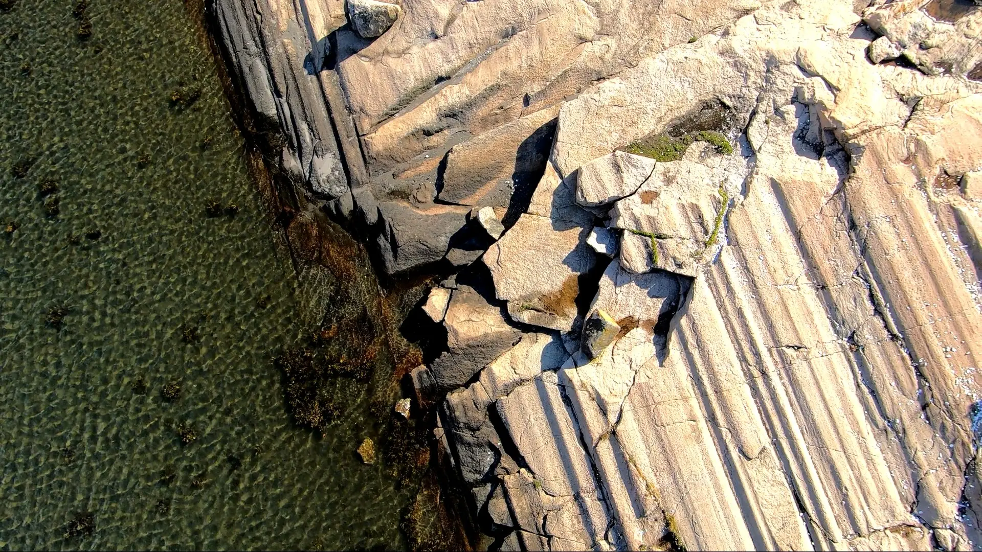
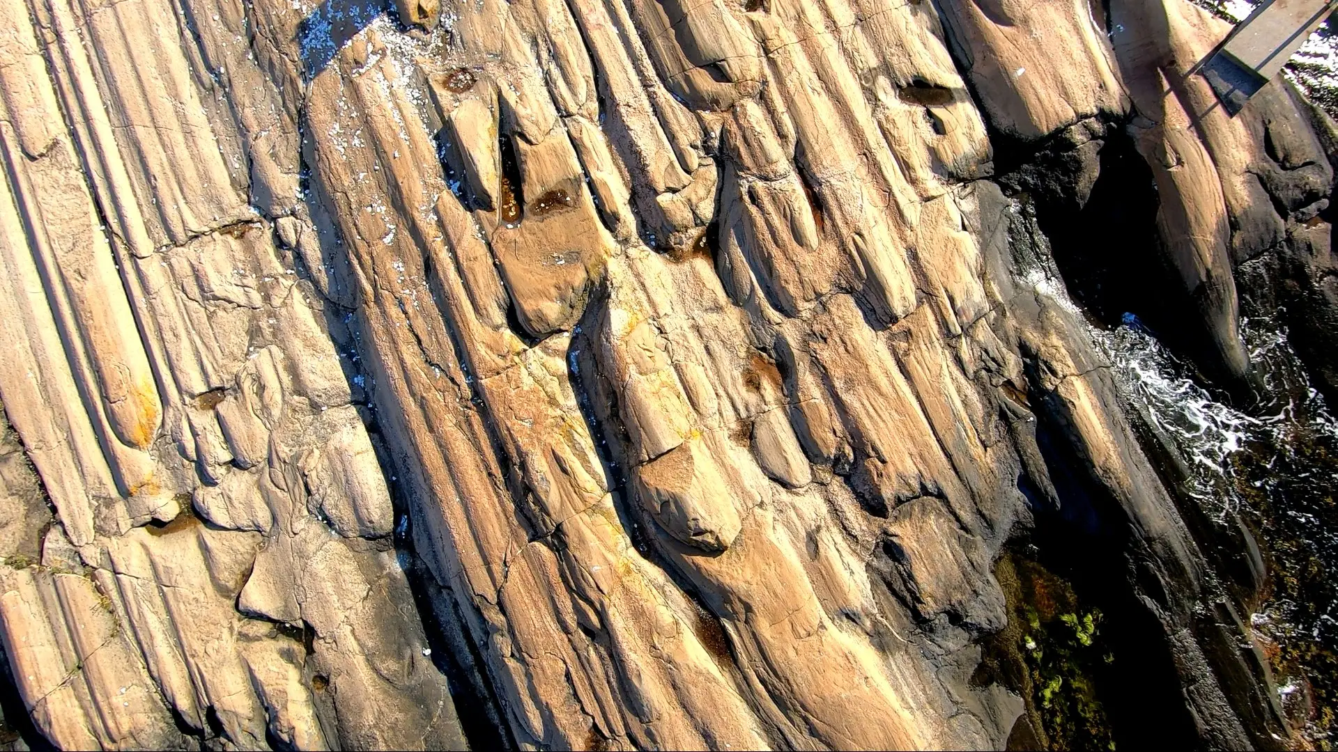
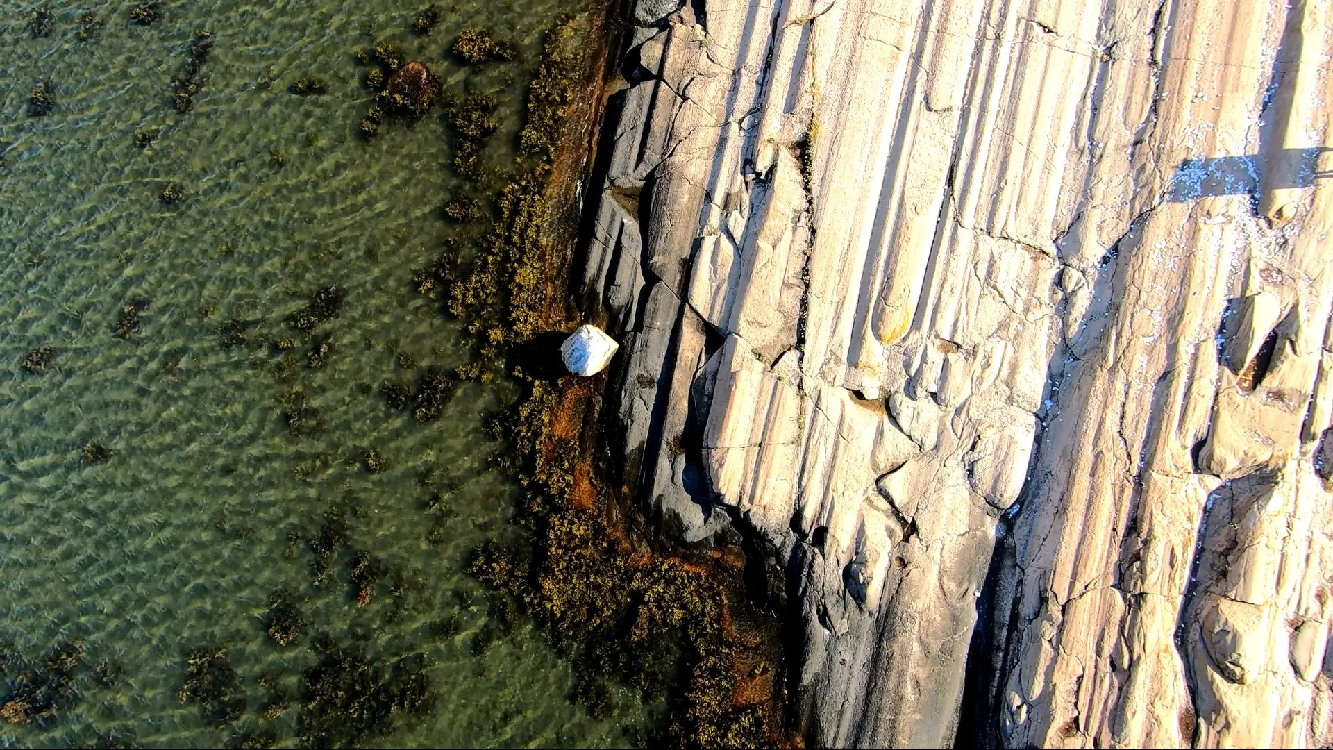
As the ice age glaciers advanced, they left a unique signature on the rocks they encountered. Large boulders carried by the glacier acted as chisels, leaving long, parallel grooves known as glacial striations on the bedrock. Observing these striations today is like deciphering the ancient language of ice, telling the story of the glaciers’ incredible journey across the landscape.
And what better way to take a closer look at these striations than using a kite and the required KAP gear?
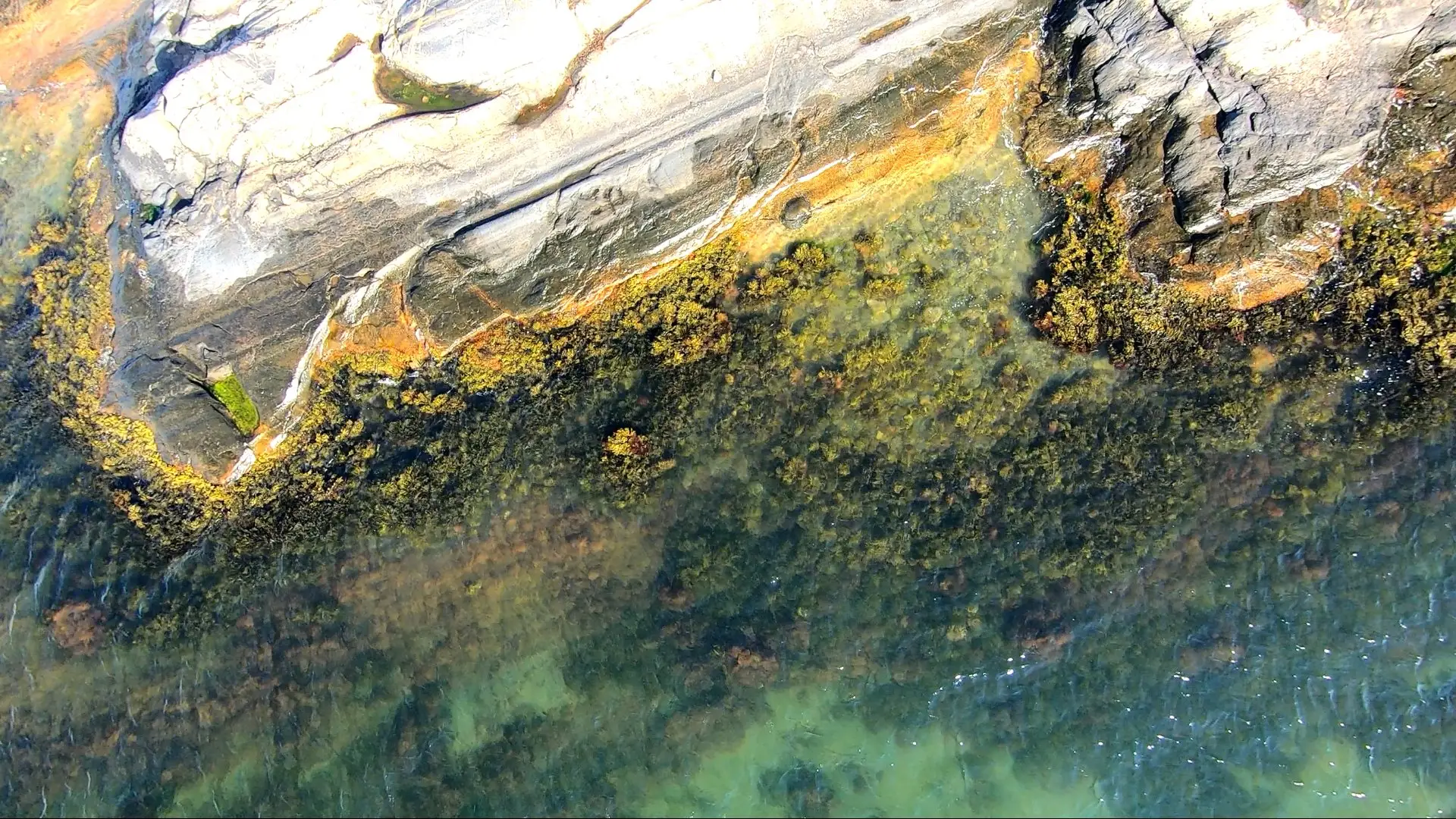
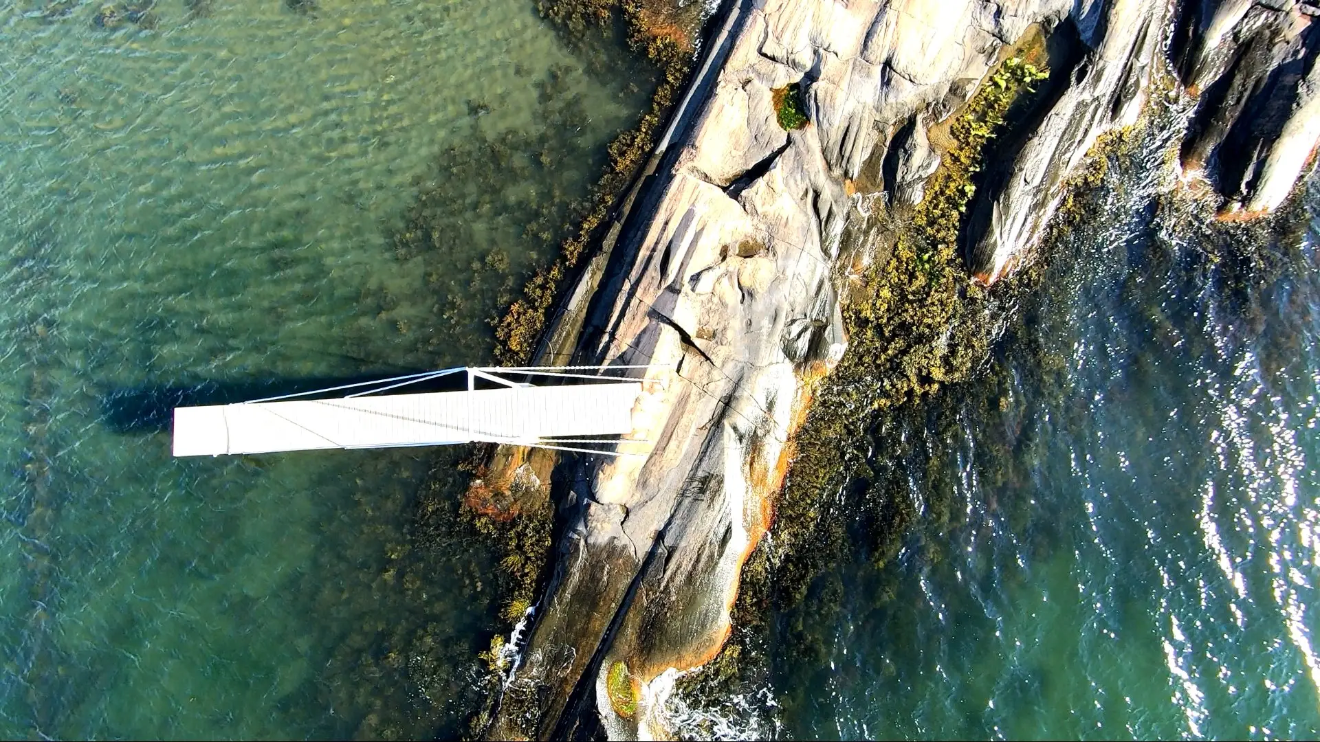
Saltholmen, a local, tiny peninsula is famous for its striated rocks, these parallell groves carved by the slow-moving masses of ice. So when rigging the KAP camera you must make sure the lense is pointing straight down. Then you let out some more line and the kite will lift the rig off of the ground. Place your camera eight to ten meters above the ground and start walking – slowly – around on the rocky part of the peninsula while capturing video or shoot photos.
You will end up with a really interesting result!
Just take a look at the awesome photos of the fascinating groves in the rocks carved by the ice thousands of years ago.